Property Record
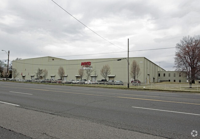
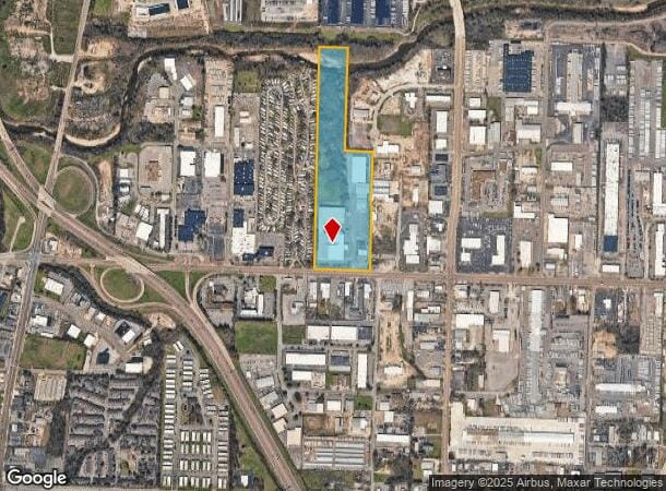
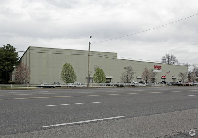
1572 E Brooks Rd, Memphis, TN 38116
NEARBY LISTINGS FOR SALE OR LEASE
Property Detail
1572 E Brooks Rd
Memphis, TN-MS-AR
Hill & Fontaine Brooks Ave Sub
06-0222-0-0219C
NS BROOKS RD TO NONCONNAH CREEK (NS) RD CONSOL PER RICK MIDDLETON L#2682-97
Foodprocessing
Shelby
AE
Tennessee
05035C0475E
32&31
2024
30.21 AC
2025
Southwest
022500
Memphis
217,994 SF
DEMOGRAPHICS near 1572 E Brooks Rd
1 Mile
3 Mile
5 Mile
2024 Total Population
7,567
52,474
177,757
2029 Population
7,919
52,701
178,721
Pop Growth 2024-2029
+ 4.65%
+ 0.43%
+ 0.54%
Average Age
36
38
39
2024 Total Households
3,069
20,764
71,125
HH Growth 2024-2029
+ 5.05%
+ 0.38%
+ 0.44%
Median Household Inc
$32,817
$33,848
$36,263
Avg Household Size
2.40
2.40
2.40
2024 Avg HH Vehicles
1.00
1.00
1.00
Median Home Value
$93,609
$74,792
$82,305
Median Year Built
1966
1959
1959
Nearby Places
Map Layers
Map Styles
 Street
 Aerial
- Restaurants
- Banks
- Shops
- Fitness
- Groceries
PUBLIC TRANSPORTATION
COMMUTER RAIL
Central Station (Riverfront Loop - Memphis Area Transit Authority Trolley (MataTrolley))
DRIVE
WALK
Distance
Central Station (Riverfront Loop - Memphis Area Transit Authority Trolley (MataTrolley))
11 min
7.4 mi
AIRPORT
Memphis International
DRIVE
WALK
Distance
Memphis International
5 min
2.9 mi
Freight Ports
Port of Shreveport
DRIVE
WALK
Distance
Port of Shreveport
406 min
375.1 mi
Nearby Properties
Address
Land Use
TOTAL SIZE
Lot Size
Zoning
Address
Land Use
TOTAL SIZE
Lot Size
Zoning
386,565 SF
29.49 AC
IH
Address
Land Use
TOTAL SIZE
Lot Size
Zoning
180,831 SF
13.11 AC
EMP
Address
Land Use
TOTAL SIZE
Lot Size
Zoning
279,419 SF
172.07 AC
EMP
Address
Land Use
TOTAL SIZE
Lot Size
Zoning
357,582 SF
5.61 AC
EMP
Address
Land Use
TOTAL SIZE
Lot Size
Zoning
146,316 SF
18.07 AC
CMU-3
Address
Land Use
TOTAL SIZE
Lot Size
Zoning
105,841 SF
7.45 AC
IH
Address
Land Use
TOTAL SIZE
Lot Size
Zoning
144,078 SF
17.93 AC
RU-3
Address
Land Use
TOTAL SIZE
Lot Size
Zoning
38,600 SF
30.35 AC
RU-3
Address
Land Use
TOTAL SIZE
Lot Size
Zoning
2,847.82 AC
EMP
Address
Land Use
TOTAL SIZE
Lot Size
Zoning
345,806 SF
33.16 AC
RU-3
Address
Land Use
TOTAL SIZE
Lot Size
Zoning
253,883 SF
37.28 AC
IH
Address
Land Use
TOTAL SIZE
Lot Size
Zoning
47.65 AC
R-8
Address
Land Use
TOTAL SIZE
Lot Size
Zoning
14,075 SF
9.36 AC
RU-3
Address
Land Use
TOTAL SIZE
Lot Size
Zoning
214,950 SF
17.05 AC
CMU-2
Address
Land Use
TOTAL SIZE
Lot Size
Zoning
1,760,826 SF
109.47 AC
EMP
Address
Land Use
TOTAL SIZE
Lot Size
Zoning
509,111 SF
EMP
Address
Land Use
TOTAL SIZE
Lot Size
Zoning
52,347 SF
11.55 AC
R-8
Address
Land Use
TOTAL SIZE
Lot Size
Zoning
81,790 SF
17.82 AC
CMU-2
Address
Land Use
TOTAL SIZE
Lot Size
Zoning
342,605 SF
82.99 AC
CA
Address
Land Use
TOTAL SIZE
Lot Size
Zoning
1,117,337 SF
127.15 AC
EMP
Address
Land Use
TOTAL SIZE
Lot Size
Zoning
165,227 SF
25.12 AC
RU-3
Address
Land Use
TOTAL SIZE
Lot Size
Zoning
71,308 SF
EMP
Address
Land Use
TOTAL SIZE
Lot Size
Zoning
42,102 SF
18.74 AC
RU-3
Address
Land Use
TOTAL SIZE
Lot Size
Zoning
203,086 SF
6.32 AC
IH
Address
Land Use
TOTAL SIZE
Lot Size
Zoning
147,890 SF
16.92 AC
EMP
Address
Land Use
TOTAL SIZE
Lot Size
Zoning
43,476 SF
4.62 AC
CMU-3
Address
Land Use
TOTAL SIZE
Lot Size
Zoning
367,132 SF
18.54 AC
EMP
Address
Land Use
TOTAL SIZE
Lot Size
Zoning
56,848 SF
1.61 AC
EMP
Address
Land Use
TOTAL SIZE
Lot Size
Zoning
233,060 SF
20 AC
EMP
Address
Land Use
TOTAL SIZE
Lot Size
Zoning
41,868 SF
3.21 AC
EMP
The World's #1 Commercial Real Estate Marketplace
Connect with us
© 2025 CoStar Group
The information above has been obtained from sources believed reliable. While we do not doubt its accuracy we have not verified it and make no guarantee, warranty or representation about it. It is your responsibility to independently confirm its accuracy and completeness. Any projections, opinions, assumptions, or estimates used are for example only and do not represent the current or future performance of the property. The value of this transaction to you depends on tax and other factors which should be evaluated by your tax, financial, and legal advisors. You and your advisors should conduct a careful, independent investigation of the property to determine to your satisfaction the suitability of the property for your needs.